Coastal Water

For questions or to get involved

(360) 461-0799

Ecosystem conservation in action: getting out of harms way while protecting ecosystem function in the Dungeness drift cell: Saving the Salish Sea

2

Feeder bluffs are a defining component of our Salish Sea.  CWI has been working for decades to understand, protect, and restore these beautiful foundations of our region. While more information can be found in our 2015 blog http://www.coastalwatershedinstitute.org/blog/?p=169, here are a few key elements:  Feeder bluffs are 150-300 foot tall coastal cliffs left behind when the glaciers retreated from of our region 15,000 years ago; Feeder bluffs are an uncohesive mix of sand, rock and clays that naturally erode as a result of wind, rain and waves; providing the sand and gravel that forms many of the beaches in our region.

The Dungeness feeder bluffs, which provide the sediment that creates and sustains Dungeness Spit, a critical National Wildlife Refuge in Clallam County, are one of the most rapidly eroding feeder bluff shorelines in the region. Erosion is highly variable and while the long term average annual landward shoreline retreat rate is ~1.5 feet per year (Parks et al 2015), the erosion rates along the Dungeness feeder bluffs may be as much as 20 feet in a single event. The scale of beach-building material delivered to the nearshore by the natural erosion of the Dungeness Feeder bluffs provides regionally significant spawning areas for forage fish which are the base of the marine food web for birds, salmon and killer whales.
Coastal Watershed Institute and Earth Economics conducted an ecosystem services valuation of the economic benefit of feeder bluff shorelines in Clallam County.  In this work, the natural process delivery of sediment to the beach by naturally eroding feeder bluffs was valued at ~$500,000 per year (Flores et al 2013).
The result of this natural erosion is the formation and maintenance of the natural processes that sustain the Dungeness Spit. In the past 40 years, many feeder bluff properties have been developed for home sites to realize the commanding views. The combination of development and erosion means that an increasing amount of feeder bluff properties are, or will be, undermined by natural erosion. CWI has been working for decades with feeder bluff landowners in Clallam County to promote conservation management.  CWI and partners have developed The Dungeness Feeder Bluff Conservation project, an innovative set of conservation strategies to protect the functions of the bluff and shoreline that create and sustain the Dungeness Spit.  This project is identified in the Puget Sound Action Agenda as an action required to protect and restore Puget Sound, but has not yet been funded.  However, the erosion continues…
For example, if you walked along the beaches west of the Dungeness Spit over the last several years, you may have noticed several large natural landslides and homes and development infrastructure hanging precariously over the bluff edge.  In 2017, one such property owner reached out to CWI for help with this very problem.   CWI went to work attempting to secure grant funds that could have removed this at-risk structure to prevent it from falling on the beach ~115 feet below.  CWI was not successful at securing grant funds, however erosion continued and the house loomed over a forage fish spawning beach along the Strait of Juan de Fuca.
Coastal Watershed Institute’s mission is to “protect and restore marine and terrestrial ecosystems through scientific research and local community, place based partnerships.”  Even though we were not funded to work on this property, we felt an obligation to our community and the ecosystem to not stand by and watch a home fall into the Salish Sea.  CWI partnered with the property owner to prevent this home from falling onto the beach below.  CWI donated time and expertise in project management and coordinated the necessary permits to remove this structure.  The property owner paid for the removal of the home out of their own pocket.
Removal of the home was completed by 2 Grade Excavation and Development of Port Angeles in November of 2020.
The entirety of the at risk home was removed, with as many materials as possible repurposed and recycled.  The building footprint was mulched and sown with native seeds to slow surface erosion.
Now, if you walk the beach below the former home site, there is no evidence of the overhanging home on the bluff or the beach. A heartfelt thank you to the neighbors and the estate of L.D. Charf for their commitment to being a proactive steward of the Salish Sea.  This home was at least the 4th to have been removed from a Clallam County feeder bluff and will not be the last. If you are a property owner along an eroding feeder bluff, please review our blog http://www.coastalwatershedinstitute.org/blog/?p=169 and contact CWI for details on how to steward your property to protect a critical component of the remarkable place we all cherish.  CWI continues to advocate for the preservation of the ecological function of natural shorelines in Clallam County and is devoted to being a community resource in the management of this complex landscape. Literature Cited Flores, L., Harrison-Cox, J., Wilson, S., Batker, D. 2013. Nature’s Value in Clallam County: The Economic Benefits of Feeder Bluffs and 12 Other Ecosystems. Earth Economics: Tacoma, Washington. http://www.coastalwatershedinstitute.org/earthEconomics.pdf Parks, D. 2015. Bluff Recession in the Elwha and Dungeness Littoral Cells, Washington, USA Environmental and Engineering Geoscience (2015) 21 (2): 129–146. https://www.researchgate.net/publication/277956367_Bluff_Recession_in_the_Elwha_and_Dungeness_Littoral_Cells_Washington_USA Puget Sound Partnership. 2018. Action Agenda for Puget Sound. https://pspwa.app.box.com/s/osxaeqg19fevxu5n3k8xnjytzkwol512 Photo Credit All photos by Jamie Michel of Coastal Watershed Institute

Beavers in our Nearshore Environment: Why Should We Care?

2
By Breyanna Waldsmith, Coastal Watershed Institute Beavers are well known “ecosystem engineers”, meaning they alter their environment disproportionately to other organisms. These ecosystem modifications include the building of resident lodges, pool-forming dam systems, and foraging channels. While most think of the small mammalian rodent as a riverine or lacustrine (lake) critter, it is well known, but little understood that the North American beaver Castor canadensis resides in saline coastal ecosystems as well. To understand the beavers’ potentially critical interactions within coastal environments, we must look no further than our local Elwha nearshore.

A Bit of Background

Human interactions with beaver in coastal North America date back for centuries at a minimum. Native tribes in the northern US and Canada utilized the beaver for meat, fashioned their teeth into tools such as chisels, and used fur as material for clothing. Eurasian citizens sought beavers for their prized furs, used principally in hat making—and ate both the flesh and the tail, which was considered a delicacy. Castoreum was also highly prized by both cultures. Utilized for its medicinal use and as an additive in foods and perfumes (creating a ‘leathery’ or ‘vanilla’ smell), castoreum is what the beaver uses to scent-mark its territory. It is an oily substance excreted from their castor sacs, which are located near the anal gland. It is often secreted along with the animal’s urine. (Rue 2002) Today, you can even buy whiskey that is made with these secretions. (Tamworth Distilling) Yum! By the end of the 15th century, the Eurasian beaver Castor fiber had been hunted and trapped to near extinction, and as a consequence, the quest for beaver products shifted to North America at that time. By the early 17th century, the North American beaver Castor canadensis fur trade was booming for the Eurasian settlers and ‘entrepreneurs’. Over the next two hundred plus years, C. canadensis followed the same fortune as the Eurasian beaver; trapped and hunted to near extinction. It is guestimated that there were up to 400 million beavers before the American fur trade boom (Goldfarb 2018). Currently, the North American population has risen again to around 10-15 million, due to help of protections placed on them in the late 19th/early 20th centuries (NWF).
However, the North American beaver still faces some degree of risk today, as their presence and behaviors are often considered pest-like to many humans. Castor canadensis are herbivorous, foraging on leafy greens and the cambium of trees or shrubs. Their teeth grow continuously and are tinged a bit reddish as they contain iron minerals for strength. (PBS 2014)

Overview of Beavers in the Nearshore

    C. canadensis are a keystone species in the nearshore estuarine environment, meaning that they have effects on both the community structure and the environmental function of local habitat. Without their presence, a broad array of other animal and plant populations depending on their services would suffer direly.     As “ecosystem engineers” beaver construct dams that serve to increase or create productive marshland habitat. This marshland not only amplifies the beavers’ area for their foraging activities, but also increases the amount and diversity of resident organisms. In the nearshore environment, this function is accompanied by a shift in the saltwater-freshwater balance of an area. The beaver dams entrap tidal waters from being released as a low tide exits the coastline, creating a valuable niche estuarine habitat. Beaver ponds are also heavily utilized by the resident fish species of an area, which in the Elwha nearshore include salmon species, but also fish such as three-spined stickleback (Gasterosteus aculeatus), prickly sculpin (Cottus asper), and Western river lamprey (Lampetra ayresii). The captured water and reduced flow rates of beaver ponds also acts to retain sediment and organic matter within the marsh. Subsequent decomposition creates a nutrient rich environment, facilitating an increase in riparian vegetation and surrounding shrubbery. This vegetation may overhang the habitat, decreasing evaporative water losses and regulates water temperatures against warming in the sun. Oncorhynchus (salmon) species require cooler water temperatures, which hold more oxygen, to survive. Resident fish also rely on these shrubs as cover to safeguard themselves against predator species in the area such as great blue herons. Another ecosystem benefit offered by beavers is the excavation of foraging channels throughout their ponds. This movement of sediment acts as a dredging mechanism to increase water depth within their ponds. The area and perimeters of the estuary and side-channel habitat are also significantly expanded: in a study by Hood and Larson on an inland ecosystem in south-central Alberta, it was found that the digging of foraging trails by C. canadensis increased wetland perimeters by over 575%, and the volume-to-surface area ratio (adding depth) by 50%, in comparison to similar areas where beavers were not present (2014). Additional area and depth protects the estuarine environment from drying up during summertime droughts, and offers the landscape increased heterogeneity, further facilitating the rise in biological diversity.
Foraging channels dug by C. canadensis can extend up to hundreds of meters, and when dug into surrounding upland forests, will increase connectivity between coastal and upland systems. This connectivity allows for greater mobility and therefore habitat availability to organisms.
Bathymetric map of [inland] beaver-created marshlands, illustrating extensive foraging channels surrounding perimeters. This study was conducted in Miquelon Lake Provincial Park, Alberta, Canada (Image adopted from Hood and Larsen, 2015). Because of their creation of this habitat, beavers support our threatened salmon species such as coho (Oncorhynchus kisutch), Chinook (O. tshawytscha), cutthroat trout (O. clarkii), steelhead (O. mykiss) and others in the Elwha nearshore. A study conducted by Gregory Hood (2012) on Skagit River found that beaver dam-created tidal pools supported over three times as many juvenile Chinook at low tide as did the surrounding shallow areas. Furthermore, those residence rates of juvenile Chinook are eight times higher once standardized by the surface area of the pools, as is commonly considered. In Hood’s study, beaver created habitat also supported other animal species such as shorebirds and amphibians. Based upon camera footage, there is further evidence to suggest that beaver burrows and lodges also encounter cohabitation by other small mammals such as muskrats and mice, with whom the beavers don’t seem to mind sharing their cover nor their food stores. (BBC)

Anthropogenic Interactions and Local Considerations

Beavers are still under threat from humans. Though hunting pressure on our coastal beavers has greatly decreased, people bringing along their dogs into the coastal environment has arisen as a new stress for the critters to navigate. Beavers can be chased, injured or even killed by unconfined dogs, and diseases are transferable between the animals as well. Beavers mate for life, and typically live around 10 years-in rare cases 15 years. They reside in a small colony, which consists of two adult parents, a couple “yearlings” (teenager equivalents) who learn building techniques from the parents, and the “kits” or baby beavers. In our own Place Road habitat near the western Elwha delta, the frequency of domestic dogs to the nearshore ecosystem has also dramatically increased. Unfortunately and not coincidentally, one of the beavers was recently found freshly dead in the middle of the main walkway to the Elwha west delta-with clear and sad signs of drag and struggle around it. The death of one beaver may not seem like a catastrophic event, but because of their colony structure, this death tears the whole working familial unit apart. Based upon dramatic regrowth of vegetation along the shoreline, and rapid filling of the west estuary side channels, and lack of new activity, indications are that the recent beaver death has caused the colony to vacate the area directly adjacent to the Place Road dike. If beavers do not return to the area, the ecosystem will alter over time; connectivity will be reduced, dredging of the side channel will not be maintained, and sediment may  infill  the most critical west side channel of the Elwha delta. (The landowners that provide access to the west side of the Elwha delta are clear: dog leashes are now REQUIRED the Place Road dike AND beach. Please use them and remain in control of your pets. A split second mistake can be costly to the entire ecosystem balance. Also, please pick up dog waste, which can spread disease to wildlife, and alter water quality.   If this conservation directive isn’t adhered to, dogs will be banned from the site.)
Two resident beavers caught on camera in the Elwha nearshore environment. (Photo by Coastal Watershed Institute) ————————————————————————————————- Another major issue beavers face is that of human development. Human development can halt or fragment the ability of C. canadensis to maintain and create the environments they and other animals depend on for survival. Human-built structures, such as dikes or shoreline armoring, generally fragment habitats, by creating a barrier between the upland and aquatic environments. Our local beavers remind us, teach us, and “dam near” force us to retain that connectivity. Specifically in the Elwha nearshore environment, C. canadensis has maintained the area surrounding the Place Road dike near the Elwha River mouth. By digging out the sediment surrounding the dike, the beavers have helped to maintain water storage on both sides of the barrier, and offer beneficial habitat to waterfowl, amphibians, vegetation, macroinvertebrates and fish. Though the beaver-created habitat on the east side of the Place Road dike has historically been sampled (by Coastal Watershed Institute) as the most heavily utilized rearing habitat for Oncorhynchus species, the west side of the dike is unreachable to these fish.. Salmon could potentially utilize this western side channel if the man-made earthen dike structure were modified to reconnect with historic estuary habitat.

The western portion of the Elwha River estuary, including the beaver lodge and pond (center), the Place road dike (left), the Elwha River main channel (far left) and the Strait of Juan de Fuca (right). Photo view is from the north, looking toward the south. (Photo by Coastal Watershed Institute, 2018)


What Else Should We Know?

To our knowledge, there are no studies yet investigating the relationship or reliance of C. canadensis on abundance and availability of soft, fine sediments. However, it is well understood that beavers build their burrows and structures using fine sediment. Once Glines Canyon and Elwha dams were removed on the Elwha River in 2012-14, the approximately 21 million cubic meters of fine sediment locked behind the dams began a journey downriver, half of which is predicted to the nearshore ( Warrick et al 2015; Shaffer et. al 2017). Before these removals, was it a challenge for C. canadensis to live on sediment-starved beaches? It stands to reason that this sediment delivery would benefit the beavers’ habitat immensely, providing them with one of the essential materials they require to build with. Unfortunately, there has been no research yet conducted on the impacts of dam removal and sediment delivery, specific to the nearshore, for the beavers. In the future, as we see other large man-made dams with projected removals, understanding the benefits or obstacles C. canadensis faces throughout restoration process is necessary. We know beavers reside in and have an impact on the nearshore—the entrance gate to our critical rivers.

Remaining evidence of C. canadensis residence of the Elwha nearshore. (Photo by Breyanna Waldsmith)

It’s time the paucity of research on beavers’ role in  restoration processes be reexamined, and that the helpful role of beaver in the nearshore be quantified. It is time the “ecosystem engineer”, C. canadensis, receive it’s due protection, and consideration, in future river conservation and dam removal projects.

Acknowledgements: Thank you to Dr. Michael Pollock (NOAA), Dr. Greg Hood (Skagit System Coop), and Dr. Anne Shaffer (CWI) for input and guidance. Thanks to Malcolm Dudley and Chuck Janda provided access to beaver sites on the Elwha. References Goldfarb, B. 2018. Eager: The Surprising, Secret Life of Beavers and Why They Matter. Chelsea Green Publishing Hood, G. A., and Larson D. G. 2014. Ecological engineering and aquatic connectivity: a new perspective from beaver-modified wetlands. John Wiley & Sons Ltd, Freshwater Biology, 60:198–208. doi:10.1111/fwb.12487 Hood W. G. 2012. Beaver in Tidal Marshes: Dam Effects on Low-Tide Channel Pools and Fish Use of Estuarine Habitat. Wetlands, 32:401–410, doi: 10.1007/s13157-012-0294-8 Leidholt·Bruner, K., Hibbs, D. E., and McComb W. C. 1992. Beaver Dam Locations and Their Effects on Distribution and Abundance of Coho Salmon Fry in Two Coastal Oregon Streams. Department of Forest Science, Oregon State University. Corvallis, OR (http://www.martinezbeavers.org/wordpress/wp-content/uploads/2018/01/Leidholt-Bruner-Beaver-Dam-Locations-and-Their-Effects-on-Distribution-and-Abundance-of-Coho-Salmon-Fry-in-two-Coastal-Oregon-Streams-Northwest-Science-1992.pdf) Miranda, D. 2017. The Community Builder: Beaver’s Role in the Ecological Community. Wetlands Conservancy. http://wetlandsconservancy.org/wp-content/uploads/2017/03/Donette-Miranda-Beavers_Role_in_the_Ecological_Community-Final.pdf Oregon Department of Fish and Wildlife. 2005. Final Report-The Importance of Beaver (Castor Canadensis) to Coho Habitat and Trend in Beaver Abundance in the Oregon Coast Coho ESU.  Public Broadcasting Service. 2014. Leave It to Beavers. USA. at http://naturedocumentaries.org/14851/leave-beavers-pbs-2014/ Pollock, M.M., M. Heim, and R.J. Naiman. 2003. Hydrologic and geomorphic effects of beaver dams and their influence on fishes. Pages 213-234 in S.V. Gregory, K. Boyer, and A. Gurnell, editors. The ecology and management of wood in world rivers. American Fisheries Society, Bethesda, Maryland. Pollock, M.M., Pess, G.R., Beechie T.J., and Montgomery D.R. 2004. The Importance of Beaver Ponds to Coho Salmon Production in the Stillaguamish River Basin, Washington, USA. North American Journal of Fisheries Management, 24:749–760. Rue, L. L. (III). 2002. Beavers. Colin Baxter Photography Ltd., Moray, Scotland. Shaffer, J.A., E. Higgs, C. Walls, F. Juanes. 2017. Large-scale Dam Removals and Nearshore Ecological Restoration: Lessons Learned from the Elwha Dam Removals. Ecological Restoration 35(2). Tamworth Distilling (Beaver Whiskey): http://tamworthdistilling.com/spirits/house-of-tamworth-eau-de-musc/ Warrick, J.A., Bountry, J.A., East, A.E., Magirl, C.S., Randle, T.J., Gelfenbaum, G., Ritchie, A.C., Pess, G.R., Leung, V. and Duda, J.J., 2015. Large-scale dam removal on the Elwha River, Washington, USA: Source-to-sink sediment budget and synthesis. Geomorphology, 246, pp.729-750.

Restarting a Sediment Engine of the Strait of Juan de Fuca: The Twin Rivers Nearshore Ecosystem Restoration

1

UPDATE: Ecosystem evolution along the Twin Rivers nearshore published: Restoration of Coastal Beach Forming Ecosystem Processes through Shoreline Armoring Removal of a Former Mine Site Increases Our Understanding of Coastal Resiliency and Large Scale Landslides Along the Northeast Pacific Coastline

Synopsis

Located on the north Olympic Peninsula along the Strait of Juan de Fuca, approximately 25 miles west of Port Angeles Washington, the Twins Nearshore Ecosystem Restoration project implements an innovative decades long collaborative project that will result in restoration of over 14 acres of nearshore habitat, including extensive eelgrass beds and surf smelt spawning beaches.
One of the largest restoration projects in the Salish Sea, the project  removed the armoring around the perimeter of a 5.6 acre earthen filled pier (also called a ‘mole’) to allow natural processes to restore over 14 acres of nearshore habitat.
The project  removed over 30,000 cubic yards of riprap (non-native rock armor), concrete and 425 linear feet of sheet pile to  allow clean native sediment that makes up the fill of the almost 6 acre mole to naturally erode and replenish the local shoreline. After fourteen years of planning and funding pursuit, armor removal began 24 July 2017 and concluded 31 August 2017.Rock armor removed from tidelands is stored on the upland portion of the Lafarge owned property. The Twins site  is very popular for beach goers. It is also an extremely important fossil site, including an important Paleolithic whale fall site.  According to Dr. Jim Goedert, Burke Museum, University of Washington:’….The Twins quarry has produced a lot of important fossil whale specimens, many of which are undescribed. Most of these specimens are in the collections for the Los Angeles Museum of Natural History (LACM), and include my favorite, Fucaia goedertorum (editor: named for Dr. Goedert and his recently deceased wife). There are also several specimens from that quarry that are in the Burke Museum collections, including the recently named new genus and species that is on display.’ Given the important of this property, CWI and staff have sponsored a number of funding proposals over the last 14 years to conserve the upland property as a public access site along with restoring the shoreline. Unfortunately, politics prevailed, so grant funding failed. As a result, we’ve had to drop the public access portion of the project and focus solely on the nearshore ecosystem restoration component of the project. Securing public access to this beautiful and important site will have to wait.

Twins Nearshore Overview

The Twin’s nearshore drift cell includes approximately four linear miles of rocky and sandy shoreline. The shoreline is highly erosional. Parks (2005) concluded that there is no long-term net apparent sediment transport direction, but rather a high degree of inter-annual variability between east/west/ and north offshore across the shore platform, and that sediment transport may be impacted by shoreline modifications. The shoreline of the Twins nearshore is a mixture of private and state ownership. A significant portion of the Twins shoreline is owned and managed by Lafarge.

Ecologically, the Twins nearshore is rich and complex. Miller et al 1985 concluded that the Twins nearshore was one of the most diverse shorelines of the Strait of Juan de Fuca. Dan  Penttila, WDFW (retired), first documented surf smelt spawning along this shoreline in 1999.  Additional spawning areas were identified along Twins shorelines in 2003 (Shaffer and Moriarty 2003).  
The site is diverse for nearshore fish assemblages, and important for forage fish,  juvenile steelhead, cutthroat, and chum migration and rearing (Shaffer and Ritchie 2008), which is consistent with ecological function of the east and west Twins Rivers documented by Roni et al. 2008. Recreationally the area is  important for fossil hunting, beach walking, surfing, crabbing, and smelting area.

Overview of the Twins Mole and Quarry

The mole is a pier structure associated with the inactive Lafarge Twin Rivers Clay Quarry, a 214-acre quarry site located immediately west of the west Twin Rivers. Elevation of the quarry ranges from 226 feet above mean sea level to mean high water. The quarry loading facility is a filled pier structure (locally termed a ‘mole’) that occupies  intertidal area directly north of the quarry .The pier (or mole) structure begins at mean high water and extends northward 250 to 300 feet into the intertidal zone to below mean low water. Elevation of the mole structure ranges from 33.2 feet to –2.2 feet below mean low water (Parks 2005). In total the mole is approximately 5.6 acres and made up of approximately 83,000 cy of fill, 20,000 cy of riprap and 425 linear feet of sheet and creosote treated piles. The structure was installed on state tidelands in the mid-1960s and operated as a clay mine during the mid-1980s by private landowners including Leonard Pfaff and Bud Schmidt. The site was first built during the early 1960’s. Operation included the dredging of the east side  to allow barge access for loading purposes. Dredging records suggest that 102,000 cubic yards (77,994 m3) of sediment were removed from the access channel between 1982 and 1985 (Parks 2005; WDOE, 1982).
The site was purchased by Lafarge  in 1998, then placed in ‘strategic reserve’ status and taken out of production. The mole is on state tidelands that are managed by the Washington DNR, and is leased by Lafarge. The current aquatic lease ends in 2020.

Twins Nearshore Ecosystem Restoration Project

Todd et al. 2006 describes the Twins nearshore as a moderately impaired stream delta complex. The mole is the feature that is impairing the shoreline by disrupting sediment transport along the shoreline and disconnecting upland sediment sources from the shoreline.  Once removed the ecosystem forming processes of the region will be largely restored.

The project removed the armoring around the perimeter of a 5.6 acre earthen filled pier (also called a ‘mole’) to allow natural processes to restore over 14 acres of nearshore habitat. Approximately 30,000 cubic yards of riprap (non-native rock armor) concrete and sheet pile were removed. Removing these armoring features is allowing clean native sediment that makes up the fill of the mole to naturally erode and replenish the local shoreline. After fourteen years of planning and funding pursuit, armor removal began 24 July 2017 and concluded 31 August 2017. Rock armor removed from tidelands is stored on the upland portion of the Lafarge owned property.

Supporters and partners of the project include the WRIA 19 community, the Washington state WDFW, and DoE, and Lower Elwha Klallam Tribe, the North Olympic Land Trust, Clallam County and Surfrider Foundation.
The project is included in the PSNERP 2011 and NOPLE 2016 work plans and the 2015 WRIA 19 Salmonid Restoration Plan. The nearshore ecosystem restoration project is led by the Coastal Watershed Institute (CWI) thru sponsorship of Lafarge. Jonathan Hall is the manager in charge of the project for Lafarge.  Dr. Anne Shaffer, CWI senior scientist, led the development of the original restoration plan and leads scientist monitoring changes as they unfold. Dave Parks, senior hydrologist and CWI collaborator,  is leading the sediment science.  Jamie Michel, nearshore restoration biologist with CWI, is  in charge of implementing the restoration project. Tara McBride, field biologist with CWI, is leading the field sampling. CWI (Peninsula College/UW) interns Seren Weber, Josh Davis, Marisa Christopher, and Mike Miller are working on aspects of the project.  The contractor is the Port Angeles based Bruch and Bruch. The site is now closed for public access, and will remain so indefinitely. Public access is a topic that the community will need to consider in the future. As in the years past, Lafarge remains open to selling the upland portions of the property for public access.

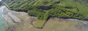
For more information on the Twins nearshore ecosystem restoration project see:

Parks, D. 2005. Preliminary assessment of sediment transport processes resulting from decommissioning of the Twin River clay quarry loading facility, Clallam County, WDNR, Port Angeles, WA. 
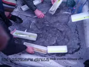
Penttila,D. 1999. Documented spawning areas of the pacific herring, surf smelt, and sand lance, in Clallam County, Washington. WDFW technical report, Olympia, Washington. Puget Sound Nearshore Ecosystem Restoration Project. (PSNERP) 2011. Nearshore Restoration Strategy for Twin Rivers. Strategic Restoration Conceptual Engineering‐Design Report. USACE, Seattle, WA and WDFW, Olympia, WA. Roni, P. R. Holland, T. Bennett, G. Pess and R. Moses. 2008. Straits intensively monitored watershed contract report: results of FY07 PIT tagging on east and west Twin rivers. Northwest Fisheries Science Center, NMFS, Seattle, Washington 98112. Shaffer, JA.2004. Nearshore mapping of the Strait of Juan de Fuca: II. Preferential use of nearshore kelp habitats by juvenile salmon and forage In T.W. Droscher and D.A. Fraser (eds). Proceedings of the 2003 Georgia Basin/Puget Sound Research Conference. CD-ROM or Online. Available:  http://www.psat.wa.gov/03_proceedings/start.html Shaffer, JA. Moriarty R, Sikes J and Penttila D 2003. Nearshore Habitat Mapping of the Central and Western Strait of Juan de Fuca Phase 2: Final Report to Clallam County  Washington. Shaffer JA, Paul J,   Crain  P,   McHenry, M., Jensen, P, Whitey, T. Parksand Schouten A, 2009. Nearshore restoration strategy for Twin Rivers: A revised proposal by the Twins nearshore restoration work group (2004, revised 2009). Port Angeles, WA. www.coastalwatershedinstitute.org. Shaffer JA and Ritchie T. 2008. Chapter 4. Fish use of the Twins nearshore. In ‘Nearshore assessment of the central Strait of Juan de Fuca.  http://hwsconnect.ekosystem.us/project.aspx?sid=180&id=10977&stat=on Smith, Carol. 1999. Limiting factors analysis WRIA 20. Washington Conservation Commission, Olympia, Washington Todd, S., Fitzpatrick, N., Carter-Mortimer, A. and Weller, C., 2006. Historical changes to estuaries, spits, and associated tidal wetland habitats in the Hood Canal and Strait of Juan de Fuca regions of Washington State.Final Report. Point No Point Treaty Council Technical Report, pp.06-1. Water Resource Inventory Area 19 (Lyre-Hoko) Salmonid Recovery Plan. Clallam County, WA.

Squid in the Nearshore

2
By Caroline Walls, biologist Coastal Watershed Institute For the first time in well over a decade, the California market squid, Loligo opalescens, has been spotted in our waters.  The squid were first reported around June 2016 by sport fishermen, and then photographed here in the Port Angeles harbor during a Coastal Watershed Institute (CWI) snorkeling survey the following month.
L. opalescens live in the eastern Pacific Ocean, from Baja Mexico up to Alaska. These squid have a short lifespan of just 4-9 months, but they play a key role in the complex food web of these waters. They are intermediate consumers in the food web, acting as both predator and prey. As their common name implies, California market squid are also an important commercial fishery, (particularly in California!). (Fields 1965; Zeidberg 2016). L. opalescens are an important food source for many different types of marine life, including seabirds, marine mammals, and fish. Common local species known to feed on them include: Brandt’s cormorants, common murres, rhinoceros auklets, various gull species, toothed whales, porpoises, sea lions, and harbor seals. Of particular note are Chinook and Coho salmon, which consume these squid in large quantities when this vital food source is available. It is unknown how salmon populations were affected by the recent absence of the squid. (Fields 1965; Morejohn et al. 1978) As predators, L. opalescens eat an estimated 20% of their own body weight each day.  They feed upon crustaceans, fellow squid, and forage fish, such as sardines, herring, mackerel, and anchovies.

Source: Morejohn et al. 1978

Such forage fish are also an important food source for Pacific salmon. This overlap contributes to the complexity of the food web of which these squid are at the center.  (Fields 1965, Quinn 2005)

The recent 15-year absence of L. opalescens is not the first. They were reportedly absent from Puget Sound waters for about a decade in the early 1950s, only to return in considerable numbers in 1958 (Fields 1965).  Little is known about these disappearances and the impact they have had on the food web.

Is this cyclic population boom and bust natural, or a result of a disrupted ecosystem?  What triggers their absence and return? How did the food web respond to their absence?  What role does this fluctuation play in our struggling marine ecosystems? How does this affect other species in the region?

Important questions we hope we can help answer.

Squid Reproductive Cycle

Researchers do know a fair amount about the lifecycle of L. opalescens, however.  L. opalescens have four life stages: eggs, paralarvae, juveniles, and adults.

Eggs are encapsulated in a sheath made of many layers of protein, and coated with bacteria, which likely helps prevent fungal infections.  Female squid deposit the eggs in sandy bottom substrates, at depths between 10-50 m.  The egg capsules are anchored in place with a sticky substance that allows them to be continually aerated without being swept away.  Masses of egg capsules are laid together into an egg bed.  If the spawning event is large enough, egg beds can cover acres of ocean floor. (Zeidberg 2016)

Paralarvae hatch from their eggs after 3-5 weeks of incubation.  At just 2-3 mm long, they must learn to swim and hunt immediately.  At this stage, they feed on copepods and other plankton.  (Zeidberg 2016)

L. opalescens are considered juveniles when they grow strong enough to swim and hunt in groups, or shoals. This typically occurs when they reach a mantle length of ~15 mm, (at approximately 2 months). As juveniles, they search for food in shoals of approximately ten individuals, and begin to hunt larger prey (as listed above) with the use of their tentacles. They perform a daily vertical migration, swimming to depths pf 500 m during the day, only to return to the surface each night to feed. (Zeidberg 2016)

L. opalescens are considered adults when their sexual organs mature, between 4-8 months of age. As adults, their average mantle length is 19 cm for males and 17 cm for females. Like other squid, L. opalescens have chromatophores in their skin, which are pigment-bearing cells that can change color in order to confuse predators, attract mates, and communicate with others. (Armstrong et al. 2012; Zeidberg 2016)

L. opalescens are mass spawners, with numbers of individuals sometimes reaching into the millions. Shoals of squid move to shallow water to spawn. It is during these mass spawning events that they are most vulnerable to predation. They are known to breed throughout the year, and it has been shown that the presence of egg sacs in an area will stimulate other females to lay eggs.  Female squid lay between 100-300 eggs. (Morejohn et al. 1978; Zeidberg 2016).

Both males and females die within weeks of spawning, but there is debate as to whether they can spawn repeatedly over the last few weeks of their lives. After their deaths, they become a food source for invertebrate scavengers as they sink to the ocean floor. (Armstrong et al. 2012; Zeidberg 2016)

Squid and Elwha Nearshore Restoration

Squid egg masses  were found along the Elwha beach wrack line for the first time in October 2016.   The CWI crew have been keeping a qualitative count since then.

Squid were also observed being eaten by gulls at the Elwha River mouth in late summer 2016. And a few squid were observed feeding on large schools of juvenile sand lance off the east delta during a late fall snorkeling survey.

Will the Elwha nearshore restoration result in more squid? We don’t know.

As a key player in our region’s marine food web, it’s exciting to witness what may to be a return of   L. opalescens to the Elwha system. We encourage and look forward to more work to understanding this fascinating  and mysterious component of our nearshore ecosystem.


Citations

Armstrong, M.; H. Buchanan and J. Davidson. 2012. (Online), Animal Diversity Web. Accessed November 07, 2016 at http://animaldiversity.org/accounts//

Fields WG. 1965. The structure, development, food relations, reproduction and life history of squid, Loligo opalescens Berry. Calif Dep Fish Game Fish Bull 131:1–108.

Morejohn GV, Harvey JT, Krasnow LT. 1978. The importance of Loligo opalescens in the food web of marine vertebrates in Monterey Bay, California. Calif Dep Fish Game Fish Bull 169:67–98.

Quinn, Thomas P. The Behavior and Ecology of Pacific Salmon and Trout. Bethesda: American Fisheries Society, 2005: 269-270.

Zeidberg, L. 1995-2016. “The Cephalopod Page” (Online). Loligo opalescens, California Market squid. Accessed November 6, 2016 at www.thecephalopodpage.org/Lopal.php.


Elwha Nearshore Rising: Beach Lake Shoreline Restoration

0
Over 100 years ago, before the Elwha River dams were built, the Beach Lake area of the Elwha shoreline along the Strait of Juan de Fuca wasn’t even a lake -it was a part of the river estuary.
Above, you can see in a 1908 map that the Elwha River had an almost mile long tidal lagoon complex that was connected to the river and was protected by a sand spit.  These back spit lagoons are critical for resting juvenile salmon, including Chinook, coho, chum, steelhead, and bulltrout, as well as forage fish. Over the course of the next century, the installation and operation of two dams in this watershed severely decreased delivery of beach forming sediment and wood to the beaches adjacent to the river. 
By 1939,  the lagoon is disconnected from the river, forming what is now known as “Beach Lake”.  Beginning in the 1950’s large rip rap armor and concrete slabs were placed on the waterward side of the north boundary of Beach Lake in a failed attempt to ‘stop’ erosion.  However, with the dams still in place the beach forming sediment supply was still cut off, and the shoreline now covered with sediment deflecting armor. The shoreline continued to erode at a dramatic rate. The majority of the remnant Beach Lake armoring disappeared into the Strait of Juan de Fuca by 2006.
By  2011 photo (above), Beach Lake was reduced to approximately 8 acres in size (a fraction of it’s historic scale).  The legacy of the armor that had been placed along the shoreline of Beach Lake to “protect” it from erosion had failed repeatedly and now instead  was littered throughout 2 acres of the intertidal shoreline-and was preventing beach forming sediment from settling.

Whats Dam Removal Got to Do With It ?

The removal of the Elwha and Glines Canyon dams began in September 2011.   In the above 2015 photo, you can see the dramatic expansion of the Elwha River delta (~100 acres of new estuary habitat) and a yellow line indicating the location of the failed armoring that was littered throughout the historic Beach Lake nearshore.  Not only was this abandoned armor no longer serving a functional purpose, it was impairing habitat for salmon and forage fish, in addition to interfering with sediment and wood delivery and other natural beach forming processes.  It had all come full circle for this armor.  First, it was put there to prevent erosion that occurred because of the dams, but after 70 years, we learned that it was not successful at preventing erosion and it was actually interfering with the beach’s ability to mend itself once the removal of the dams delivered a 100-year pulse of sediment to this shoreline.

Comparing the above 1950 and 2016 photos of this shoreline, you can see a dramatic shift from a sandy vegetated natural beach to a heavily altered beach that was littered with abandoned armor rock up to 6 feet in diameter.

In 2015, at the 9th Annual Elwha Nearshore Consortium workshop, Jamie Michel ( CWI nearshore biologist and project lead), initiated and led an interdisciplinary dialog that identified, for the first time, the direct relationship between shoreline armoring and the  persistent  erosion on this stretch of Elwha shoreline. And the first ecosystem restoration project of the Elwha nearshore was born. Coastal Watershed Institute approached the owner of a portion of this shoreline about their interest in a conservation sale of their property so that this stretch of shoreline could be restored to a natural beach and made available for the public to visit.  The landowner was very supportive of this concept as were the U.S. Fish and Wildlife Service (USFWS), Washington State Department of Ecology, Washington State Recreation and Conservation Office (RCO) and the Puget Sound Partnership.  Puget Sound Partnership  designated this project, named the Beach Lake Acquisition and Restoration Project, their #1 Habitat Priority in their 2016 Puget Sound Action Agenda which is available here.  In August of 2016, Coastal Watershed Institute purchased this property with funds from USFWS and RCO and immediately began the process of bringing this shoreline back to its full potential.  All of this happened just in time, as the beach forming sediments made available by dam removal will only be in this stretch of shoreline for  a short duration as the high wind and wave energy quickly moves sediment along this shoreline.  If we had waited any longer, we may not have had the chance to allow this beach to rebuild itself naturally.

Dawn, August 13, 2016, construction crews get to work removing armor from this beach.
By 11 am the tide has come in and the beach work concludes for the day.
Over the course of 6 days, approximately 3,000 cubic yards of abandoned armor and 100 cubic yards of concrete were removed from 2 acres of tidelands along 1/2 mile of shoreline so that this shoreline can repair itself.

Elwha Nearshore Rising

Within just one tidal cycle, natural processes were able to deliver beach forming material (sand and wood) to the upper portions of the beach and some areas of the beach grew upwards by almost 10 feet and outwards by 20 feet.  Pretty amazing how capable a natural system is of repairing itself once we get the impediments out of the way.

Above is a beautiful August 20, 2016 aerial photo of the expanding Elwha River delta and newly restored shoreline.  Notice how a lagoon system is beginning to re-establish to the left of the river’s mouth.  Who knows how this shoreline will continue to evolve now that another significant natural process impediment has been removed, but we are excited to watch and learn.
None of this work would have been possible without the partnership and support of numerous organizations.  The Lower Elwha Klallam Tribe was a key partner in the restoration. Bruch and Bruch Construction provided an outstanding team of equipment operators to get Phase I of the rock removal accomplished.  (Pictured above with the 3,000 cubic yard mountain of armor removed from the beach are (L-R Yonara Carillho of SWCA Environmental Consultants and George, Dale and Daryl of Bruch and Bruch Construction).  Additional partners essential to this project include: The Phillips Family, North Olympic Land Trust, John L Scott Real Estate, Washington Department of Natural Resources, Washington Department of Fish and Wildlife, Clallam County, U.S. Army Corps of Engineers, North Olympic Peninsula Lead Entity for Salmon Recovery, Coastal Geologic Services, Stratum Group, 2 Grade Excavation, LLC, Patagonia (which is funding our ongoing monitoring), Olympic Peninsula Surfrider Foundation, Ecotrust, Olympic Peninsula Audubon Society, Hayes Family Foundation, Rose Foundation, The Seattle Foundation, Puget Soundkeeper Alliance and Lighthawk.

Dr Anne Shaffer, lead scientist at CWI, leads the monitoring efforts underway on the project.

Over   2016-2018, the project beach continued to evolve as high energy winter storms and king tides rearranged the shoreline.  Portions of the newly deposited sediment were whisked away, but were just as quickly replaced by newly accumulated large woody debris (LWD).  In the years when this shoreline was heavily armored, the LWD just bounced off of the armoring and was not delivered to the upper beach.  LWD is a key structural component that helps create beach stability and we are excited to see that this habitat-sustaining and beach-forming feature has been naturally re-integrated into this ½ mile of shoreline as a result of dam removal and shoreline armor removal.  Along the Strait of Juan de Fuca, it is common for beaches to erode in the winter and then rebuild with beach forming material delivered by alongshore transport and summer swell.  The ability of a beach to retain the summer delivery of beach forming material through winter storms is greatly enhanced by the presence of LWD which helps to lattice the beach together.   In the photo below, you will see that the old ‘sentinel’ snag that was an eagle perch and photo reference point has fallen over, but is now one of many new pieces of LWD on the beach.

Something else we have noticed is the re-emergence of shoreline armor that was buried within the beach last August when we conducted Phase I of armor removal.  Because of the decades long legacy of failed armor attempts, we knew that this was likely to happen as buried armor ‘swam to the surface’,  so the project was permitted to allow armor removal from the beach as it surfaced from 2016-2021.  In 2016 we removed ~3,000 cubic yards of abandoned armor from the shoreline (~150 dump truck loads) of the estimated 8,000 cubic yards that were a part of the failed armor structure that was littered on top of and within the beach.

During a daylight negative tide that occurred on the last Friday of April 2017, we mobilized a construction crew to remove all the abandoned armor that was visible on the beach surface.  Approximately 25 dump truck loads were pulled from the beach for a volume of ~500 cubic yards of concrete slabs and rip rap boulders removed from the beach.

What Happens Next?

The upland restoration of the property is mostly complete and the site is ready for public visitation.  We continue to monitor the shoreline for newly emerged armor, beach change, forage fish spawning, beach wrack, beach invertebrates and LWD.  So far we have mobilized heavy equipment 14 times and have removed approximately 80% of the armor that was estimated to be littered on 2 acres of tidelands along ½ mile of the project area shoreline. Check back for more updates as they happen.

Image may contain: ocean, sky, outdoor, water and nature

-by Jamie Michel, Project Lead

Forage fish of the Elwha and Dungeness nearshore: world class restoration and protection in the upper left hand corner of the United States.

0

Following complete removal of the last dam from the Elwha River it appears that the nearshore food webs have begun to repair themselves.  During a recent lower river and estuary seining, the Coastal Watershed Institute (CWI) documented, for the first time, hundreds of gravid and spent eulachon Thaleichthys pacificus- a federally listed river spawning smelt (watch a video of the field observation here).

The eulachon’s common name “candlefish” derives from the fact that they are so rich in oil that, when caught, dried, and strung on a wick, they can be burned like a candle!  Eulachon have historically been a culturally important species to indigenous cultures. Eulachon also provide such a significant energy source to the entire aquatic food web that they are federally protected.  Eulachon spawn at the most upstream extent of tidal influence in a river and require fine sediments to successfully reproduce.  Because the Elwha River dams altered sediment delivery to the lower river, eulachon and have been nearly absent from the Elwha system for the past six decades.  Now that dam removal has re-established natural river sediment processes, we are thrilled to know that eulachon are returning to this restored habitat so quickly and in such abundance.  The dozens of seals, sea lions, and thousands of birds are even happier!
In January 2015 Coastal Watershed Institute also observed the first ever Long fin  smelt, Spirinchus thaleichthys, in the Elwha nearsh ore. Long fin are also river spawning smelt. This was a gravid female. The term ‘forage fish’ refers to a  group of pelagic schooling fish (including eulachon, surf smelt, long fin smelt, sand lance, and herring) that are a critical food source for larger fish, birds  and marine mammals including Chinook salmon, bull trout, alcids, gulls, and seals, sea lions, and whales. Eulachon and longfin smelt   spawn on fine grain sand in lower rivers thru winter and spring. Surf smelt and sand lance spawn in the mid and upper intertidal areas of  very specific grain size  beaches-surf smelt spawn here in summer-sandlance spawn here in winter. Herring spawn on eelgrass and seaweed during early spring.  In healthy nearshore ecosystems, forage fish and forage fish spawning are prolific, but in far too many coastal areas they are experiencing significant declines.
For example, here on the Olympic Peninsula, forage fish spawning along the Elwha drift cell is a mere fraction compared to other areas, including  the adjacent and intact Dungeness drift cell, where relatively abundant and consistent surf smelt spawn along feeder bluffs is supported by  complex seasonal bluff feed rates and volumes of specific grain size sediment.
In the Elwha nearshore, dam removal creates an unprecedented opportunity to jump start and restore these vital forage fish communities and the higher predators that depend upon them. And the Elwha drift cell provides a cautionary tale on how important it is to protect intact nearshore systems for forage fish, such as the Dungeness bluffs drift cell.

While spawning is low in the Elwha drift cell, it’s common to seasonally see extremely large schools of adult and juvenile sand lance (Ammodytes hexapterus), surf smelt, and herring (Clupea harengus pallasi) migrating along our shorelines and feeding  in the kelp and eelgrass beds of the Elwha and Dungeness nearshore (see sand lance and herring in our nearshore here: http://vimeo.com/106125199 and   video of a recent juvenile herring storm in the Elwha nearshore here:  http://vimeo.com/104661826) .   It is so important to protect these nearshore habitats critical for these important forage fish species.

In July 2014, Coastal Watershed Institute and a group of young National Geographic Explorers documented that surf smelt (Hypomesus pretiosus pretiosus) expanded their spawning range in the Elwha nearshore and spawned on new beaches that were created as a result of dam removal. You can read about our July sampling here.  We continue to sample for new spawning areas for surf smelt and sand lance and other forage fish as they arrive. Stay tuned.

Ongoing field efforts to chronicle these unique ecological changes in the nearshore central Strait including the Elwha, Dungeness drift cells take many hands and ongoing funding.   WDFW, WCC, DNR, UW, UVic, Salish Sea biological and our Peninsula College/WWU and other student interns and die-hard photographer partners are essential.
A big thank you goes out to all of you for heavy lifting under all weather conditions!  Funding for this work is provided by Olympic Peninsula Chapter of the Surfrider Foundation, University of Washington, University of Victoria, Patagonia, Puget Soundkeeper Alliance, Rose Foundation, Seattle Foundation/Hayes Family Foundation and private donations. Join us.

High Feeder Bluffs: What they mean to you, and how to understand natural processes to inform a community ‘Living on the Edge’

0
The views are as magical as they are temporary atop the Dungeness Bluffs-which form the backbone of Dungeness Spit.  Dungeness Bluffs, Spit, and Bay are fragile, unique, and tightly  interdependent landforms that are ecologically and economically important to our region. These high bank bluffs began forming and retreating as sea level rose and glaciers receded from the Olympic Peninsula,
leaving behind a 100-300 foot thick legacy of highly erodible nearshore and beach building clay, sand, gravel and cobble deposits along the Strait of Juan de Fuca.
These features are ‘feeder bluffs’-through natural erosion they are the sediment source for our nearshore including beaches, offshore substrate, and spits-including Dungeness Spit-a nationally treasured federal wildlife refuge. Natural erosion of these bluffs is a constant process of wind, waves and rainfall that results in the retreat of the Dungeness Bluffs  at a (highly variable) average rate of 1.5 feet per year.  This rate is a long-term average and individual bluff failure events have included erosion of as much as 20 feet in a single event.
Residential development began along these 30-story high vistas in the 1970s, and continues today. During development, bluff hydrology-metering shoreline vegetation is first to go as trees are cut for views. Then impervious roofs, parking, and lawns are installed.  Water is further concentrated on these parcels by onsite septic systems and insufficient storm water conveyance. Yard waste is often side cast over the bluff edge in an ‘out of sight, out of mind’ philosophy. The result: erosion is exacerbated.   And what seemed (when first built), to be a reasonable distance from the edge, vanishes. Today, more and more of these homes hang within feet of the edge.

What science tells us/What we know:

1. High bluffs are complex, unique nearshore systems

The feed rate of sediment from feeder bluffs is very complex. Feed volume, rate, and composition, varies by season and year.

2.  These high bluff features are fundamentally erosional-this process is unstoppable.

3.  Their management is also unique. Including:

  •  Foremost, ‘soft techniques’ becoming more familiar in other areas of lower energy regions of Puget Sound are not effective on high feeder bluff shorelines. Specifically,
  • Parcel scale ‘soft armoring techniques’ won’t work on high bluffs. Sediment delivery and wood dynamics are simply too large and complicated to attempt to mimic at a parcel scale. Only restoration of sediment processes at the ecosystem scale may restore and maintain feeder bluff systems.
  • Native vegetation along the top and face of high feeder bluffs plays a very important role in high feeder bluff dynamics-including erosion. Once native vegetation is removed and surface hydrodynamics are altered, erosion will start to accelerate. Once activated, this fundamental shift in the dynamics of the feeder bluff may be difficult to undo.
  • Restoring’ native vegetation is a fine thing to do-but restoring the root systems that pull adequate water, reestablish angle of repose on destabilized bluff faces, and provide a stabilizing net along the bluff edge and face may take decades-and may not be possible at all.
Bottom line? High feeder bluffs are large scale eroding features. This erosion is inevitable and necessary. Residing upon a large feeder bluff means you are integrated into a potentially hazardous,   large-scale, geologic and hydrologic process.
Landowners there will interact with, but cannot control, these processes. The only way to successfully manage these forces on one’s home  is to live elsewhere, and protect these critical features intact.

What to do?

First and foremost: Undeveloped bluff properties should be conserved.

For properties that are developed:

New homes should be sited at least 200 feet back from the top of the bluff edge (providing approximately 100+ years of time until erosion becomes an issue). Erosion rates are too variable and development actions have too much interaction with bluff dynamics to develop closer with any certainty.

Native long lived vegetation provides important bluff edge stabilization that cleared edges and mowed lawns do not. Native vegetation should absolutely not be cleared from the bluff edge and face. Trees should not be topped, and yard waste should absolutely not be side cast onto/over bluff edges.

Careful consideration should be given to storm water and septic systems as additional water storage and runoff often exacerbates bluff erosion. If these cannot be managed to completely avoid increased interaction with the bluff system the site should not be developed.

While often offered as a popular engineering tool, armoring of high bluffs is  expensive and the science is clear: armoring of high bluffs doesn’t stop erosion but instead increases it. Armoring just won’t solve the problem and leads to intractable and additional landowner costs as well as devastating effects to fish and wildlife. Look to the Elwha drift cell to understand that armoring is expensive, does not solve the problem and results in more armoring.

And for those unfortunate landowners that  have built along high bluffs, and are currently at risk? These properties should be removed from the real estate market for both safety and ecological reasons and not sold  to other uninformed landowners.

What can we do? Educate, and work together.

  1. Continued community education on best bluff management practices
  2. Develop and coordinate a relief funding source, process, and plan for acquisition of distressed properties and relocation of homes away from the bluff edge.
  3. Begin protecting intact feeder bluffs-your favorite beach, fish, and marine ecosystem depends on it.

Additional resources

Link to average erosion rates by parcel along Dungeness and Elwha drift cell: http://www.arcgis.com/home/webmap/viewer.html?webmap=89f3c6777a554d01808d26b9b5856cc5&extent=-123.6961,47.9973,-123.0273,48.2599

The Last Beach; https://www.dukeupress.edu/The-Last-Beach/


Thanks to LightHawk for assistance with aerial imagery


Restoration Sediment Now Arriving on Sediment Starved Elwha Feeder Bluffs: Understanding Sediment Delivery to the Elwha Nearshore

0
The Elwha drift cell extends from Freshwater Bay to the end of Ediz Hook.  Beaches along the Elwha drift cell have been starved of sediment for over a century as a result of shoreline armoring of critical feeder bluffs and the Elwha River dams.  
However, now that both Elwha River dams have been removed, approximately 3,000,000 cubic meters of previously retained river sediments have already arrived to the nearshore.  Although the dam removal project was recently completed, the nearshore transformation has just begun…
As a result of dam removal, over 16,000,000 million cubic meters of river sediments will reach the Strait of Juan de Fuca at the Elwha River mouth.  About half of those sediments are sand, gravel and cobble that could potentially re-establish natural beaches along the shoreline.
Soon after dam removal began in September 2011 the beaches to the west of the Elwha River mouth along Freshwater Bay were the first to benefit from the return of Elwha River sediments to the nearshore.  In August 2014 Coastal Watershed Institute documented surf smelt spawning on the beaches of Freshwater Bay and the new river delta surfaces. Read about it here.
However, It is not well understood how river sediments will be transported and deposited to 7 miles of sediment starved beaches east from the river mouth to the end of Ediz Hook.
Dave Parks, senior resource scientist and hydrogeologist at Washington Department of Natural Resources, has been  working with CWI and WWU and Peninsula College interns conducting a long-term shoreline change study to help understand when and where sediments formerly detained by the Elwha dams will be deposited on the beaches of the Elwha drift cell.
Recent sampling by Dave Parks has shown that over a meter of new sand has been deposited on the low tide beach terrace along unarmored feeder bluffs approximately 1.5 miles east of the Elwha River mouth. This is just the beginning of sediment delivery to the sediment starved beaches of the Elwha drift cell. What does this mean ecologically?
Feeder bluffs that are fronted by broad, flat, and sandier beaches erode more slowly than those without. So if sufficient, sediment deposition from the Elwha restoration will help slow erosion along sediment starved steep course beaches of the Elwha nearshore.  And for fish? Similar beaches along Dungeness Spit drift cell support surf smelt spawning,  indicating that, if restored properly, beaches along the Elwha drift cell could support surf smelt spawning in the future. Coastal Watershed Institute has been working with our partners along central Clallam County shorelines for over a decade to predict how these sediments recently made available by dam removal may be transported along beaches of the drift cell  and define restoration opportunities  of the upcoming delivery of Elwha River sediments  to sediment starved beaches between the Elwha River mouth and the end of Ediz Hook.  We have alot more to do. Coastal Watershed Institute will hold the 9th annual Elwha Nearshore Consortium in February 2015 in Port Angeles.  The event will feature one day of technical presentations and one day of public workshops and site visits.  Stay tuned for more details and updates about exciting changes to the shoreline and opportunities to be involved in the evolution.

Next steps for the Elwha nearshore

0
On Tuesday, 12 August 2014, Jamie Michel, CWI nearshore biologist and Kathryn Neal, City of Port Angeles, updated NOAA, DFW, and DNR management on key priorities for the Elwha nearshore and the City of Port Angeles. The city, after literally a decade of urging by the local citizens, local and regional scientists and managers, has taken the first step to solve the problem of the City of Port Angeles landfill. If done well part of this solution will optimize upcoming sediment delivery from Elwha dam removals, reverse 100 years of sediment starvation, and protect/restore critical nearshore of the feeder bluffs of the Elwha nearshore. CWI continues to lead this dialog and is dedicated to collaboratively realizing solutions that benefit the community and the Elwha nearshore-and the national resources it supports. It’s been a surprisingly challenging effort to get these world class nearshore management issues and restoration opportunities onto the radar of a few of our federal management agencies. Thankfully WDFW, DNR, DoE, the CoE, and EPA are helping. And with leadership from Sissi Bruch, Dan McKeen, and Craig Fulton,  we’re now making headway.

The industrial waterline conveying water from the Elwha river to city of Port Angeles mills was unwisely installed on the Elwha bluffs shoreline in the 1920's. The landfill is burning on the bluff in the background.

Over the next 100 years  sediment starvation due to shoreline armoring associated with the industrial waterline and in river dams transitioned the Elwha  nearshore from a intact beach and bluff system to a severely sediment starved and hostile ecosystem. Surf smelt spawning extent along the Elwha bluffs compared to intact Dungeness bluffs illustrates the impact of this sediment starvation.

In 2006 the City of Port Angeles installed a sea wall in front of the landfill. The seawall has a band-aid. It slowed garbage from falling into the Strait, but also exacerbated  shoreline erosion. The sea wall quickly began to deteriorate, and require costly maintenance, now underway. The sea wall was not permitted federally.

Dam removals offer over 100 years of river sediment, approximately 16 million cubic meters, to the Elwha nearshore. This could reverse sediment starvation in the Elwha nearshore, and reset the Elwha nearshore on a new trajectory.
In 2013, with new city leadership and staff, the City of Port Angeles began efforts to solve the landfill problem. With funding from DoE they are in the first phase of removing landfill from the bluff shoreline.

CWI and the City hosted a meeting with NOAA, WDFW, and DNR management  on 12 August 2014 to update agencies on the status of the landfill project and top priority next steps for Elwha nearshore restoration that have been   identified by the Elwha Nearshore Consortium over the last decade.


We still have a lot to do-we need to do it now.

Join us.


2014 Surf smelt and National Geographic in the Elwha nearshore. Jenna Moore, Central Washington University/Peninsula College and CWI intern

0
On July 28, 2014, the Coastal Watershed Institute team was joined in our Elwha nearshore surf smelt sampling by the National Geographic Young Explorers! Carol Holman, Dave Parks, Dan Penttila, Nicole Harris, and Anne Shaffer continued our long term surf smelt spawn study  and mapped beach sediment along west Elwha nearshore along with the help of CWI interns Tara McBride, Jenna Moore, and Jesse Wagner, and National Geographic students and leaders from around the world. Landowners and staff provided critical access and support so we could work up samples in a group on site.
National Geographic and Central Washington University/CWI students sampling newly transformed beach for surf smelt spawn 28 July 2014
A number of CWI supporters donated backpacks for carrying samples, and photos to document the day.
What did we find? Surf smelt are spawning on the brand new river delta. A year ago this habitat didn’t even exist! The addition of sediment is allowing for greater nearshore habitat for many fish species, in the Elwha nearshore including the vital surf smelt. Our adage for Elwha nearshore function-build it and they will come (as soon as it’s available)-holds. And our bottom line? 
There are heroes in our world. Here are a few of them.
See national geographic blog for student http://trips.ngstudentexpeditions.com/pacificnorthwestb2014/