For questions or to get involved
(360) 461-0799High Feeder Bluffs: What they mean to you, and how to understand natural processes to inform a community ‘Living on the Edge’


What science tells us/What we know:
1. High bluffs are complex, unique nearshore systems
The feed rate of sediment from feeder bluffs is very complex. Feed volume, rate, and composition, varies by season and year.
2. These high bluff features are fundamentally erosional-this process is unstoppable.
3. Their management is also unique. Including:
- Foremost, ‘soft techniques’ becoming more familiar in other areas of lower energy regions of Puget Sound are not effective on high feeder bluff shorelines. Specifically,
- Parcel scale ‘soft armoring techniques’ won’t work on high bluffs. Sediment delivery and wood dynamics are simply too large and complicated to attempt to mimic at a parcel scale. Only restoration of sediment processes at the ecosystem scale may restore and maintain feeder bluff systems.
- Native vegetation along the top and face of high feeder bluffs plays a very important role in high feeder bluff dynamics-including erosion. Once native vegetation is removed and surface hydrodynamics are altered, erosion will start to accelerate. Once activated, this fundamental shift in the dynamics of the feeder bluff may be difficult to undo.
- Restoring’ native vegetation is a fine thing to do-but restoring the root systems that pull adequate water, reestablish angle of repose on destabilized bluff faces, and provide a stabilizing net along the bluff edge and face may take decades-and may not be possible at all.


What to do?
First and foremost: Undeveloped bluff properties should be conserved.
For properties that are developed:
New homes should be sited at least 200 feet back from the top of the bluff edge (providing approximately 100+ years of time until erosion becomes an issue). Erosion rates are too variable and development actions have too much interaction with bluff dynamics to develop closer with any certainty.
Native long lived vegetation provides important bluff edge stabilization that cleared edges and mowed lawns do not. Native vegetation should absolutely not be cleared from the bluff edge and face. Trees should not be topped, and yard waste should absolutely not be side cast onto/over bluff edges.
Careful consideration should be given to storm water and septic systems as additional water storage and runoff often exacerbates bluff erosion. If these cannot be managed to completely avoid increased interaction with the bluff system the site should not be developed.
While often offered as a popular engineering tool, armoring of high bluffs is expensive and the science is clear: armoring of high bluffs doesn’t stop erosion but instead increases it. Armoring just won’t solve the problem and leads to intractable and additional landowner costs as well as devastating effects to fish and wildlife. Look to the Elwha drift cell to understand that armoring is expensive, does not solve the problem and results in more armoring.

What can we do? Educate, and work together.
- Continued community education on best bluff management practices
- Develop and coordinate a relief funding source, process, and plan for acquisition of distressed properties and relocation of homes away from the bluff edge.
- Begin protecting intact feeder bluffs-your favorite beach, fish, and marine ecosystem depends on it.


Additional resources
Link to average erosion rates by parcel along Dungeness and Elwha drift cell: http://www.arcgis.com/home/webmap/viewer.html?webmap=89f3c6777a554d01808d26b9b5856cc5&extent=-123.6961,47.9973,-123.0273,48.2599
The Last Beach; https://www.dukeupress.edu/The-Last-Beach/
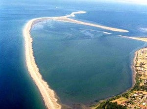
Thanks to LightHawk for assistance with aerial imagery